Local Area.
The Great Lakes
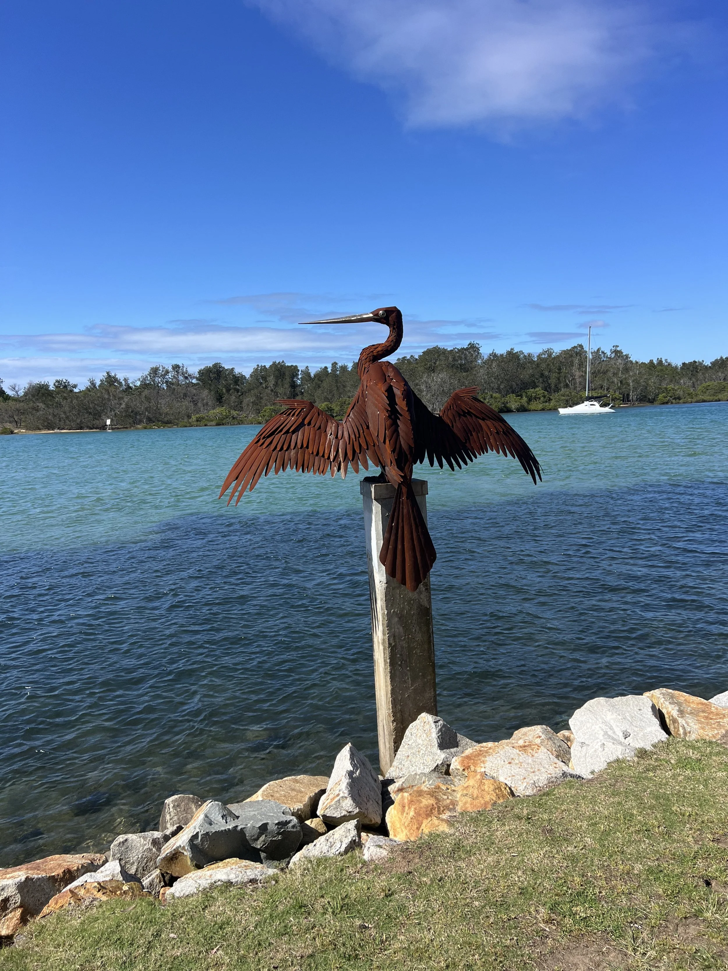
The Great Lakes region is an all-year-round water wonderland. Famous as a fishing and boating destination, it offers many activities both on the water and from the land.
The three main lake systems are the Myall Lakes system, which lies to the south between Bulledelah and Hawkes Nest; Smith’s Lake, which lies on the northern edge of the Myall lakes National Park near Seal Rocks; and Wallis Lake, which enters the sea at Forster Tuncurry and spreads north and south and inland as far as Coolongolook just, 20 minutes from the farm.
If you have a boat there are literally thousands of kilometers of waterways to explore and enough space to always be able to find a quiet spot away from any crowds. While the lower reaches lend themselves to powerboats and small yachts, the upper reaches are ideal for canoes and kayaks.
Commercial operators provide hire-boats, houseboats, and paddle craft at various venues and there are hundreds of places to go for a picnic, fish from the banks or to go for a swim from the shoreline.
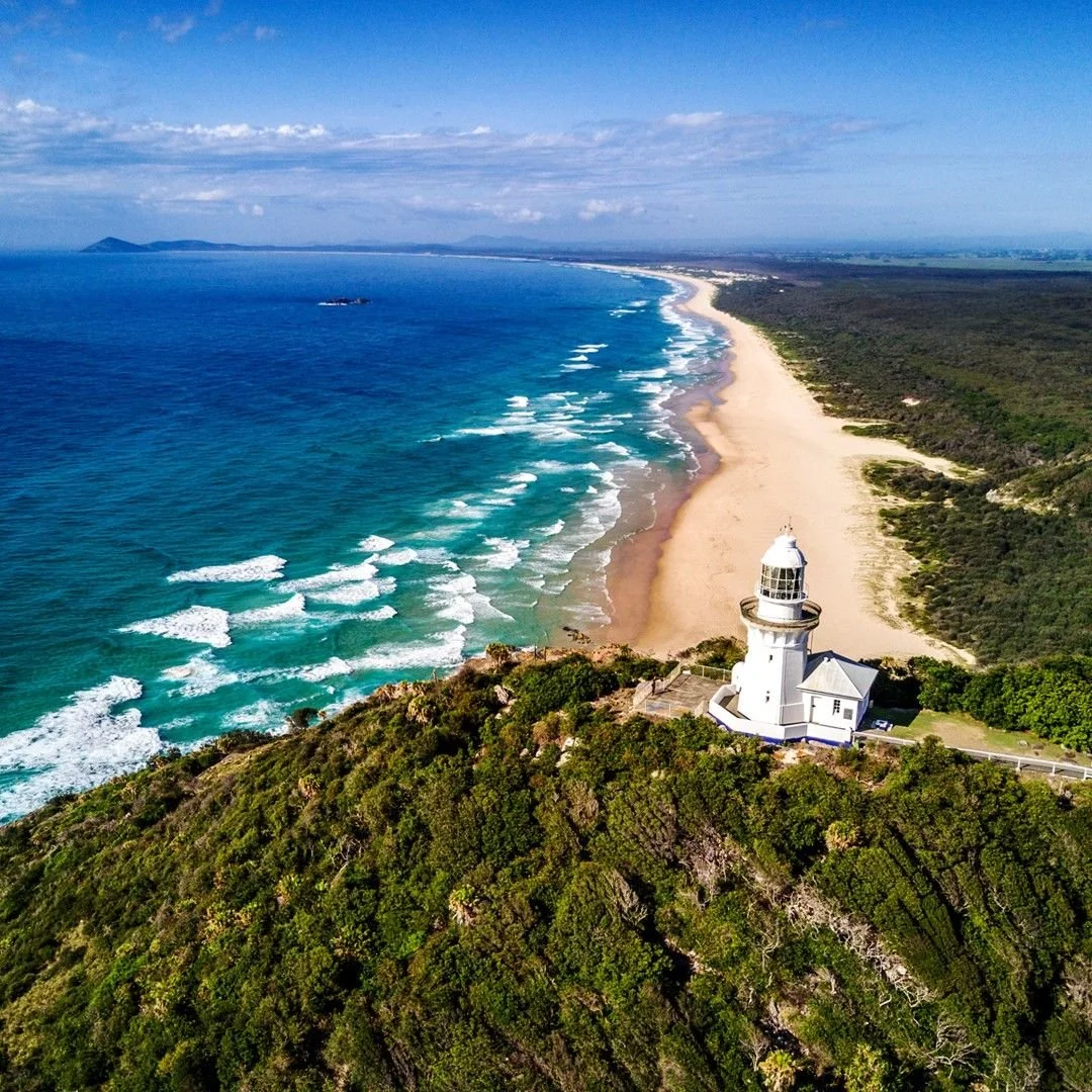
On the coast adjacent to the lakes are an extensive range of stunning surf beaches. Some are small and secluded, some are ideal for surfers and some offer 4wd access for the dedicated surf fisher folk.
For more information on activities in the area go to:
Barrington Coast
Encompassing the Great Lakes, Manning Valley, Gloucester, and Barrington Tops plateau, the region spans 10,053 kms² on the lower mid-north coast of New South Wales: from world heritage Barrington Tops wilderness to the glittering Pacific Ocean
Pursue a path less trodden, to wander wild highlands into ancient Gondwana rainforests, where nature abounds at every turn. Watch peaceful creeks pour over towering waterfalls, forming fertile valleys rich in agriculture and abundant with fresh produce, rural charm and welcoming smiles.
Follow meandering rivers that ebb through bustling towns and delightful retreats, and bathe in the beauty of our untouched lakes and estuaries. Complete your journey at the place where the path ends, swept away by the ocean waves that shape our breathtaking beaches. For this is the Barrington Coast – where the leaves touch the waters, from the mountains to the sea.
For comprehensive coverage of the activities, events, and places of interest, visit:
Barrington Tops
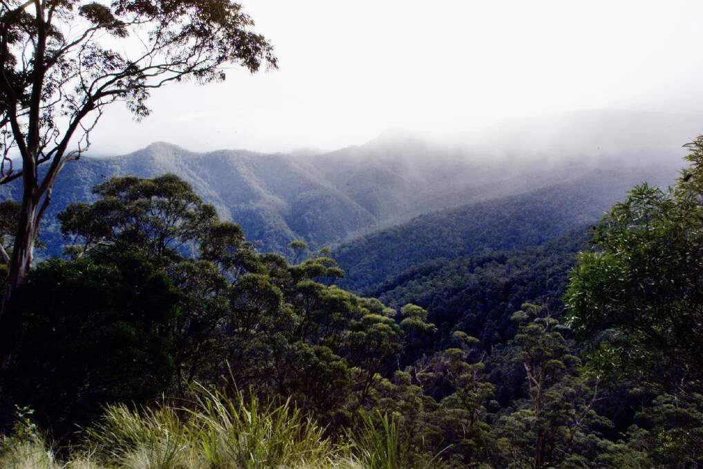
The rainforests in Barrington Tops National Park are part of the Gondwana Rainforests of Australia World Heritage Area; the most extensive strip of diverse rainforest anywhere on earth. The World Heritage Area is a direct window into the past and the future, providing a link to the ancient pre-human world and a stunning and irreplaceable record of life on our planet. You can explore the rainforest on one of the park's many walking tracks, like the Honeysuckle Forest track, the Rocky Crossing walk or the Antarctic Beech Forest track. Listen out for the lyrebird whose mimicking calls ring out through the rainforest.
Barrington Tops National Park and the adjoining State Conservation Area are the traditional land of several Aboriginal groups, including the Worimi and Biripi people, the Gringai clan of the Worimi people and Wonnarua people. The rainforests of Barrington Tops offered a wealth of resources for Aboriginal people, including many edible fruits, like the native cherry, lilly pilly and figs. Today, the history of Aboriginal people in Barrington Tops is recorded in oral history and in the presence of Aboriginal sites. Barrington Tops National Park protects ancient campsites, scarred trees and sacred ceremonial places.
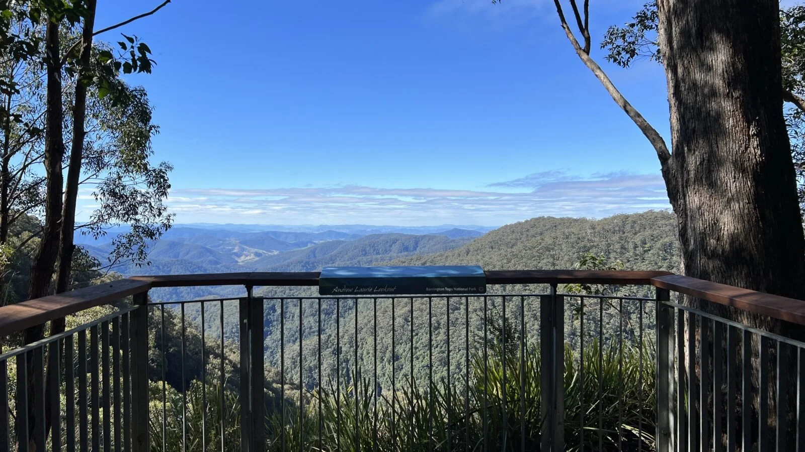
Most of Barrington Tops National Park is declared wilderness; large, natural areas of land that, together with their native plants and animal communities, remain essentially unchanged by modern human activity. Wilderness areas in NSW represent the largest, most pristine natural areas within NSW - the last of Australia's wild and untamed places. The edges of the wilderness area of Barrington Tops are easily accessible; some of the most spectacular views in the park are from Careys Peak and Devils Hole and Thunderbolts lookouts. You'll notice the varied textures of the forest below you, with the ranges of the Barrington Wilderness running east and south from the plateau like the fingers of an outstretched hand.
For detailed information visit:
Gloucester Tops Circuit
Part of the 8km Gloucester Tops circuit
Walk through snow gum woodland and ancient rainforest to lookouts and waterfalls, along the Gloucester Tops circuit. This 8km loop combines 3 popular and scenic walks in Barrington Tops National Park
Gloucester Region
To truly enjoy the rich variety of activities in Gloucester and surroundings you should start at the Gloucester Visitor Centre. They have a remarkably rich and comprehensive collection of simple brochures (mostly folded A4 sheets) that provide details for:
* Gloucester Boomerang Discovery Walk
* Mosaic Walk
* Gloucester - Points of Interest
* Copeland Tops State Conservation Area: Mountain Maid Gold Mine Tour
* Copeland Tops State Conservation Area: Basin Loop Trail
* Copeland Tops State Conservation Area: Hidden Treasure Trail
* Woko National Park
* Barrington Tops National Park - with a detailed map
* Barrington Tops - Camping
* Swimming - Gloucester
* Scenic Drives - 1: Buccan Buccans Circuit
* Scenic Drives - 2: Gloucester Tops
* Bicycle Touring and Mountain Biking
* Vineyards Farmgates & Farm Tours